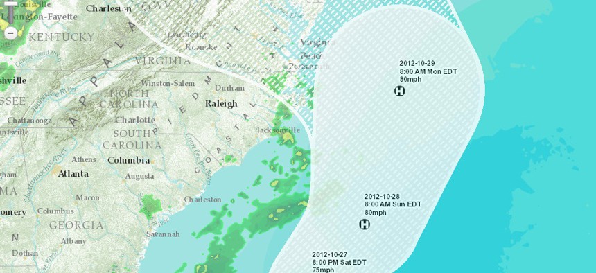


[Interactive Map] Track Hurricane Sandy in Real Time
Map aggregates weather and social media to track the storm's approach in real time.

Story updated Oct. 27 at 11:15 p.m. EST.
As the East Coast braces for Hurricane Sandy, reports are already coming in that the storm has left at least 39 dead across the Caribbean. The hurricane will next track north where it is expected to merge with a winter storm crossing the continental U.S.
When the cold air from the winter storm collides with the warm air of the hurricane, the resultant "Frakenstorm" is expected to unleash a burst of destructive weather. If the storm wreaks havoc over the heavily populated Eastern U.S., experts are predicting at least $1 billion in damages.
From "Frakenstorm" to the "Storm of the Century," Hurricane Sandy's collision course with the cold front out of the west has earned it a range of unique superlatives.
The Associated Press reports Sandy may be much worse than the 1991 storm famously known as the "Perfect Storm:"
Sandy is "looking like a very serious storm that could be historic," said Jeff Masters, meteorology director of the forecasting service Weather Underground. "Mother Nature is not saying, `Trick or treat.' It's just going to give tricks."
Some have compared the tempest to the so-called Perfect Storm that struck off the coast of New England in 1991, but that one hit a less populated area. Nor is this one like last year's Halloween storm, which was merely an early snowfall.
"The Perfect Storm only did $200 million of damage and I'm thinking a billion" this time, Masters said. "Yeah, it will be worse."
Follow Excellence in Government on Twitter | Facebook | Google + | LinkedIn