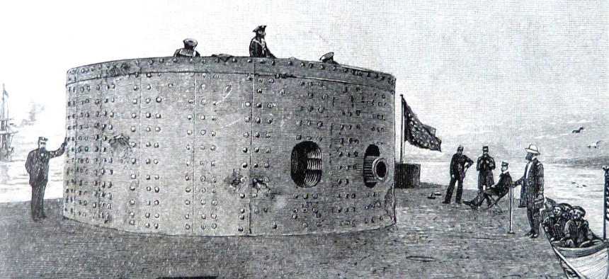
The USS Monitor, designed by the Swedish-born engineer and inventor John Ericsson, was the first ironclad warship commissioned by the United States Navy during the American Civil War. SeM Studio/Fototeca/Universal Images Group via Getty Images


Inside the Federal Government’s Mission to Explore a Sunken Civil War Battleship
"Everywhere you look, wonder and awe," the NOAA marine archaeologist leading the exploration said, previewing the first-ever livestream of the area.

Growing up in Hawaii, Tane Casserley’s school spent about one afternoon covering the Civil War.
One thing stood out from his memory of that brief history lesson: an illustration of the Union’s USS Monitor locked in battle with Confederacy’s CSS Virginia. The ironclad Monitor fought the Virginia to a draw in the 1862 Battle of Hampton Roads, but later sunk during a storm off the coast of North Carolina. Now, 160 years later, Casserley is a marine archaeologist for the National Oceanic and Atmospheric Administration and leading a federal mission to explore and live stream the wreckage on the ocean floor.
That office is sharing costs with the National Centers for Coastal Ocean Science, and is collaborating with the state of North Carolina and the Global Foundation for Ocean Exploration. The expedition will run from May 15 to May 25 and include daily livestreams as Casserley’s team sends remotely operated vehicles down to the Monitor and other shipwrecks in the area.
The Valor of the Atlantic journey will start and end with the Monitor and provide archaeological data to inform historians, as well as marine life data that will allow NOAA and other stakeholders to better protect the area. The shipwrecks have become like a reef, a magnet for fish and other marine life that drives the local fishing industry.
“Ecologically, it's incredibly important because of the habitat,” Casserley told Government Executive as he was departing from Charleston, South Carolina, in the NOAA ship Nancy Foster. “Economically it's incredibly important, because of the funds and the tourism it brings to Coastal Carolina. And then historically, of course, it's incredibly important to document our past and work with our federal partners to help them manage their sites as well.”
The Monitor's location was unknown for more than 100 years, until a research team, with assistance from the National Science Foundation, located it in 1973. It then became the first National Marine Sanctuary, with NOAA leading the effort to protect and explore the site. It hasn't launched an in-depth survey of the shipwreck since 2002, when, in partnership with the Navy, it recovered the ship's gun turret. Nicole LeBoeuf, director of NOAA's National Ocean Service, said new technologies that become available will offer unprecedented access to the Monitor and other shipwrecks, for both researchers and the public alike.
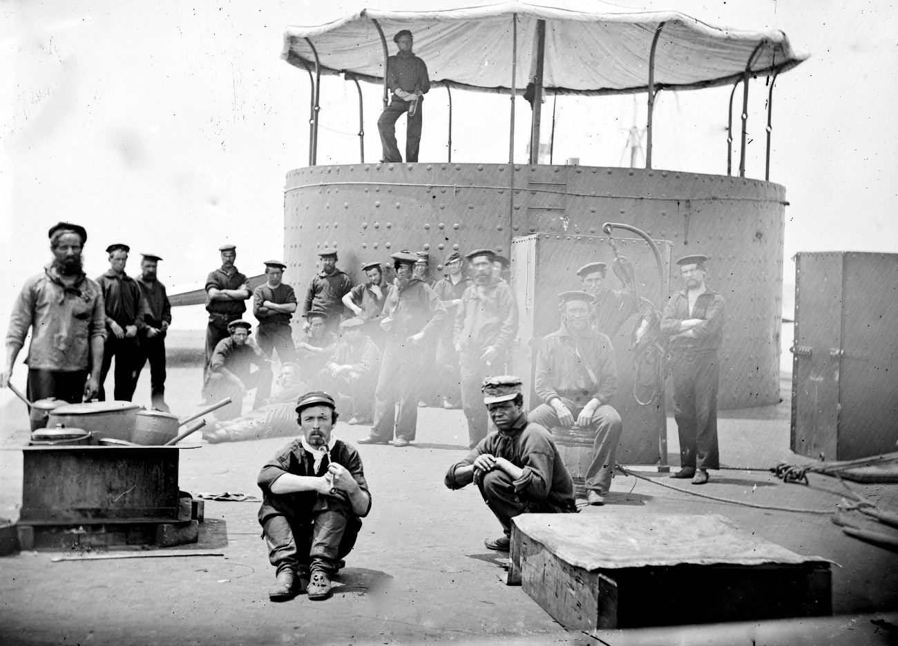
Casserley, a 22-year NOAA veteran who has previously dived to the Monitor and touched it, said he is most excited about the live broadcast and subsequent "360-video" that will enable the public to explore the shipwreck with virtual reality goggles. The public, he predicted, will be wowed by the “oases of life” and the “huge swaths of color.”
“You've got the historical aspects of these gigantic shipwrecks on the bottom and the huge fish and the predators that are calling this home, so when you come in, it's almost like an African Safari,” Casserley said. “It's just everywhere you look, wonder and awe.”
The team will send down two remotely operated vehicles, one with the cameras and the other that will provide a spotlight. The livestreams will be narrated at times by local dive shop or restaurant owners, so the public can hear residents in the area react to what they are seeing in real time.
NOAA will take the lead on analyzing the data to better understand how shipwrecks evolve to become major supporters of marine life, while the North Carolina Office of State Archaeology will take the lead on developing historical insights. The Global Foundation for Ocean Exploration is contributing much of the technology that will enable the live broadcasts, which Casserley said will enable the public to see things for the first time at the same moment the scientists are also making those discoveries. There are a dozen engineers and archaeologists on board the Nancy Foster and about 20 officers and crew, all of whom will live on the ship for about two weeks.
Many of the wrecked ships the NOAA team will visit met their fate due to hurricanes and other storms. Some were brought down intentionally by a nascent Air Force attempting a proof of concept that planes could sink a battleship. Others were sunk by World War II-era German U-Boats.
“To see that history of naval battlefields on the seafloor right off the U.S. east coast, is a huge reminder how close the war came to the American shore,” Casserley said. “When you immerse yourself in that direct connection to that part of history, it's incredible.”
Casserley, who often dives with 180 pounds of equipment and goes to depths of 260 feet—well beyond the range of recreational diving—has helped document many wrecks. His current mission will allow him to stay primarily above water thanks to an unusual setup to which he is not accustomed.
"It's hard for me to describe what it looks like here," Casserley said, likening the set up on the Nancy Foster to the inside of a NASA Space Center during a launch. "It's pretty cool, I'm not gonna lie. I'm super lucky."
You can watch the livestream here beginning May 15.
NEXT STORY: Wanted: New Vaccine Advisory Committee Members