Death Valley National Park


Welcome Spring With This Forest Service Map of the U.S. Blooming
Maps from the agency show signs of the season across America's forests, fields, and urban areas.
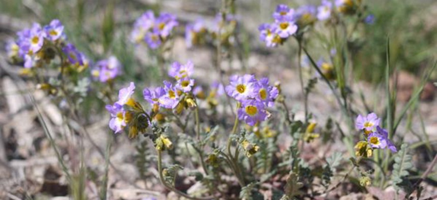
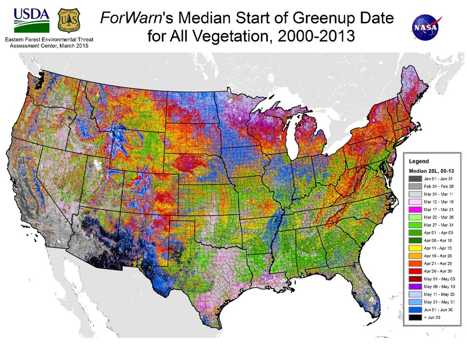
Here on the East Coast, it's finally feeling like spring. And the good scientists at the U.S. Forest Service are offering proof of this miracle via the satellite-tracking tool ForWarn —mapping in glorious Technicolor the beginning of seasonal greening, or "greenup," across America's forests, fields, and urban areas.
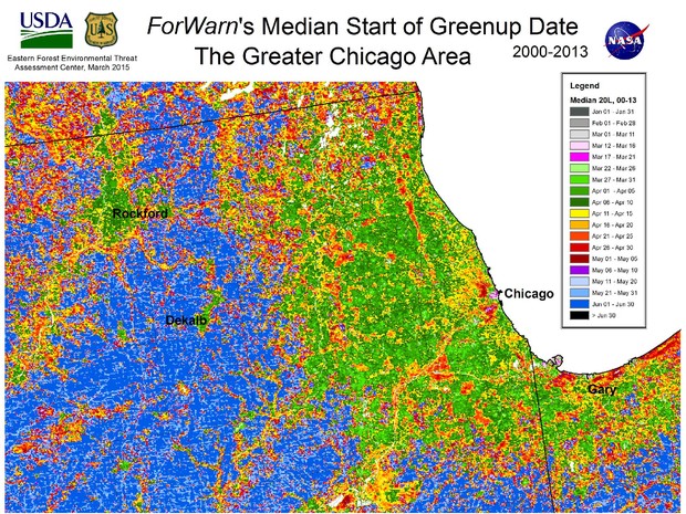
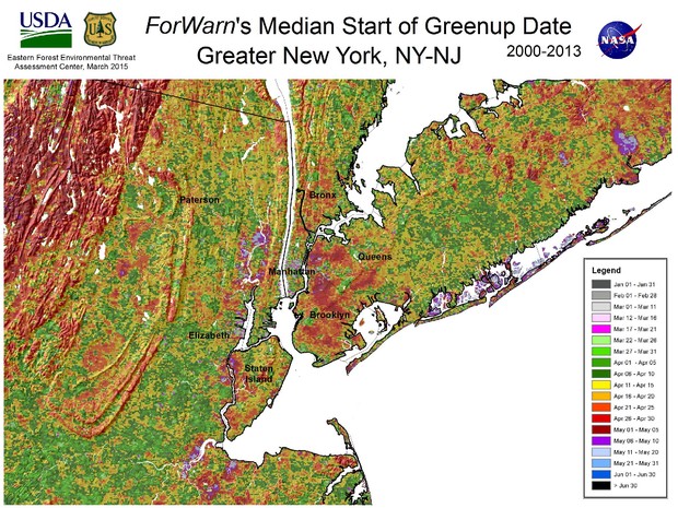
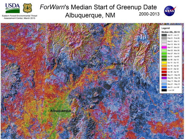
It's important to note that greenup doesn't always mean "spring," since some climates and plants don't have the traditional four seasons . But greenup does indicate the transition of one season to another, between January and June. The map above shows the median greenup date from the last 14 years of millions of pinpointed locations nationwide, based on satellite imagery.
This is eye candy to most of us, but greenup information is helpful to land managers as they "anticipate and plan for the impacts of disturbances such as weather events and insect pests," according to a press release.
"The start of the annual growing season is among the most important climate-sensitive measures that ForWarn can provide," said Forest Service research ecologist Steve Norman . "Just as gardeners look to climate data to determine the typical last frost date, the typical greenup dates provides a baseline for land managers to establish expectations for seasonal duration and productivity."
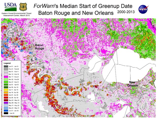
Forwarn and the Forest Service also mapped greenup dates across a handful of U.S. cities , where every block can be a complex intermingling of native and non-native plants. In many urban centers, spring springs at different times in different neighborhoods.
NEXT STORY: How the 2016 Republicans Will Debate NSA Reform