NOAA


Meet Hurricane Arthur, Your July Fourth Party Crasher
Forecasters expect the storm to pass over North Carolina's Outer Banks on Friday night.

Arthur is growing up so fast. The tropical storm graduated to a hurricane Thursday, picking up speed and strength as it moves north up the coast of the United States.
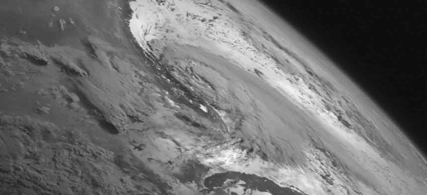
Arthur, the first hurricane of the season, is not expected to be a very strong one, but it sure looks menacing from space. This image, captured Wednesday by NASA and National Oceanic and Atmospheric Administration satellites, reveals a large, swirling mass over the Atlantic Ocean.
Forecasters expect Hurricane Arthur to pass over the Outer Banks, a 200-mile string of barrier islands along the coast of North Carolina, on Friday night. On Thursday, officials ordered a mandatory evacuation of about 35,000 people from Hatteras Island, located at the southern tip of the Outer Banks. Forecasters expect heavy rains and winds, as well as dangerous rip tides.
None of this is good news for Fourth of July celebrants on the Outer Banks, a popular summer vacation spot that was expected to see more than 200,000 visitors this weekend.
But North Carolina Gov. Pat McCrory wants residents to get their priorities straight. "This is no time to put your stupid hat on," he told CNN's New Day on Thursday, warning people to stay off the beach and out of the ocean
Leave your stupid hats at home, folks. And your party hats. Just stay inside.